Firescald Ridge along the Appalachian Trail, Greene County, TN.
Rugged trail with fantabulous summit. 360 degree mountain vistas.
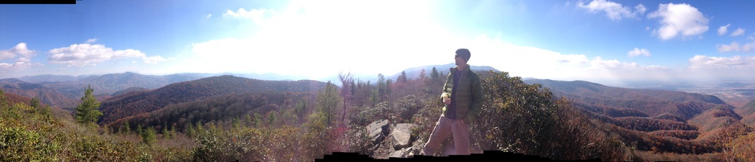
The Hike: Okay, this one is a bit of a drive. Maybe almost an hour and a half from Johnson City, finishing with gravel switchbacks. But seriously, if the sky is relatively clear and the forecast looks good, you need to take the half day to check out this fairly rugged, undulating trail that summits along Firescald Ridge. The day we went, Johnson City highs were in the 50s but way up at the start of this hike (over 4,000 feet), it was 39 degrees with no wind. This was perfect, because it was a moderately strenuous hike that warmed us up. Summitting along the ridge, we were taking our hats and gloves off, unzipping our coats, and laying on the rocks like happy little lizards in the sun.
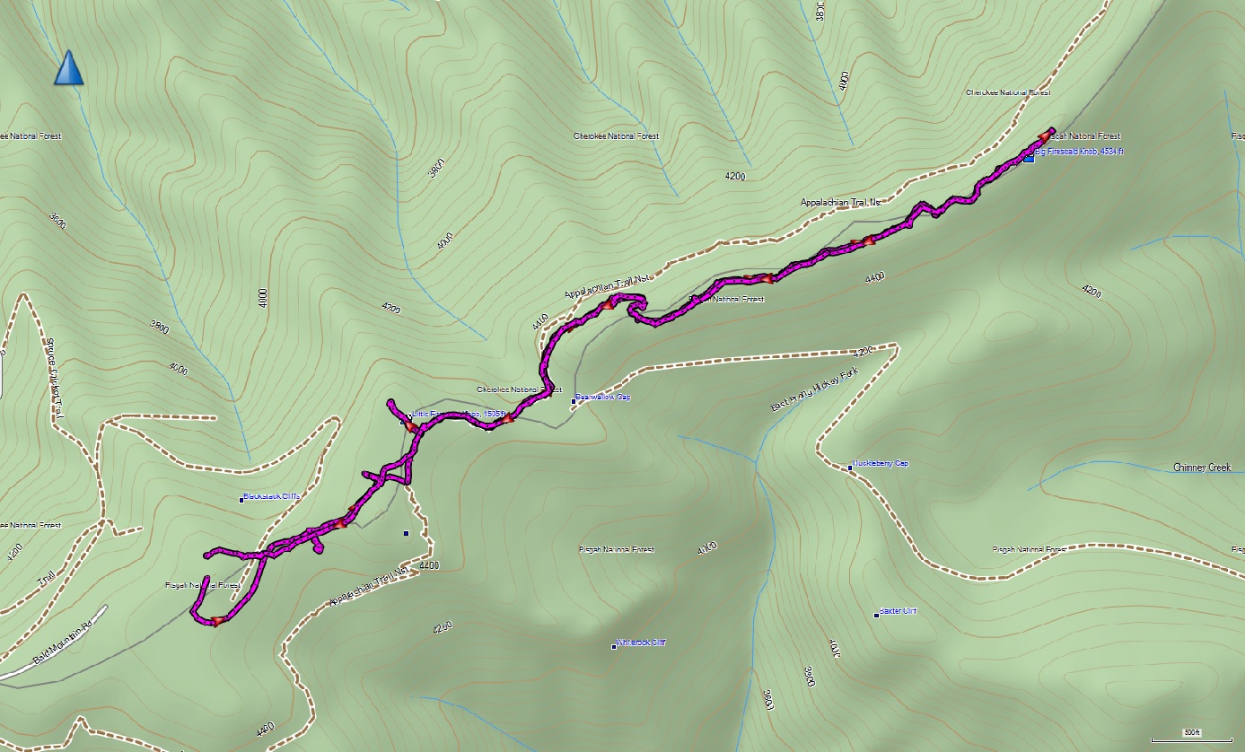
From the parking area, follow the blue blazed trails (in the opposite direction of the look-over) until you intersect the single white-blazed Appalachian Trail. Go left, and follow that trail until you reach a V where you will see a sign marking the "exposed ridgeline trail" and the "bad weather trail." Take the exposed ridgeline, of course! (We told our kids that there was bad weather on the other trail!) Our GPS had us at about 1.75 miles when we reached the exposed portion or, the summit. The trail is fun and rugged all along, lots to hold kids' interest, but the WOW factor when you reach the summit will make it totally worth any not-so-fun moments that come along with family hiking. Hang out on the ridge and soak up the sun, then turn around and head back the way you came in.
Directions:
The photo, left, is from the longish gravel drive. It's a grinder, but on a day like that one, you get your money's worth!. Thanks to The Monkey's Mask Presents for the excellent directions:
From ETSU, follow Southwest Ave until the stop sign and turn right onto Cherokee St. Follow Cherokee St until it comes to an end at a stop sign and make a left onto TN-81.
Shortly after crossing over the Nolichucky River on TN-81, turn right onto TN-107 for about 16 miles. At a stop light, turn left from TN-107 onto TN-351. Stay on TN-351 for 11.3 miles and then make a left onto TN-70, aka the old Asheville Highway.
Follow TN-70 for 6.6 miles, then turn left onto Viking Mountain Road. Follow Viking Mountain Road as it winds up from the valley toward Camp Creek Bald. Eventually Viking Mountain Road becomes Bald Mountain Road not far from where the road spits out onto Jones Meadow.
On top of the ridgline, the road comes to a three-way intersection. Take the road headed left and park, the start point has been reached. Be wary of taking the road all the way to big dirt parking area if you are driving a low clearance vehicle. There are hidden and cringe-worthy bumps as the road descends into the area.

| firescaldridgemap.jpg |
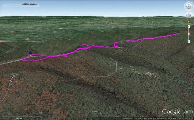
| firescaldridge.kmz |
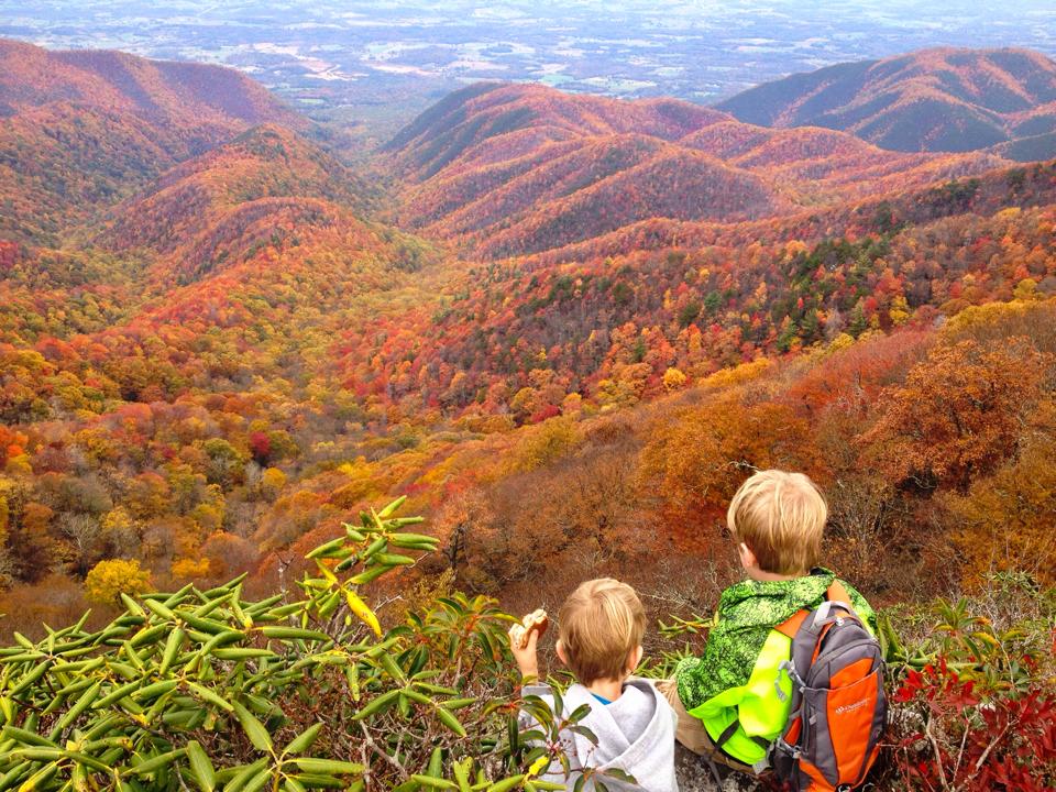
How do you get your kids to hike? People ask me this question pretty often. Over the years we've developed some tricks including telling long and fantastical stories, choosing hikes with geocaches, waterfalls, bridges, or other features that "are surely coming up just over this hill," and even delivering little candies like Mike and Ikes at intervals to kids with "strong legs and enduring spirits." But we hardly ever use these tricks. Mostly, when our kids complain we do what everybody else does: tell them to quit it, yell at them to quit, and eventually sit down in the trail, exasperated, and beg them to quit. On this hike, we had a certain someone repeatedly stating that "hiking is boring" and whining about getting mud on his shoes (regarding a pair that have been through the wash at least three times after unrestrained mud walking by this same individual). At the apex of all this, one of the adults started morosely suggesting we turn around and head back to the car and the other one, (o.k., it was me) started quoting Annie Dillard: "We come to abet creation and to witness to it... so that nature need not play to an empty house," followed by a lengthy interpretation. Of course, none of this worked, especially the literary quoting. Shortly after, I found a cool snail and handed it to my pouting offspring. I guess it was a magic snail. From that point we had a happy hiker. When we reached the exposed ridge, he was as thrilled and stunned by the vistas as we were. Looking back, Steve and I agreed that 30 minutes of touch-and go complaining over the course of an 8 hour outing (counting driving, dinner, etc.) and the ridge vistas among other awesome moments were totally worth it. And so I say: hike with it all, the complaining, the sore knee, the pang of frustration about the healthy snacks you left on the kitchen counter as you rushed out the door. It is totally worth it.
