Spivey Gap to High Rocks on the Appalachian Trail.
A dreamy woodland stroll ending in a vista unspoiled by human design.
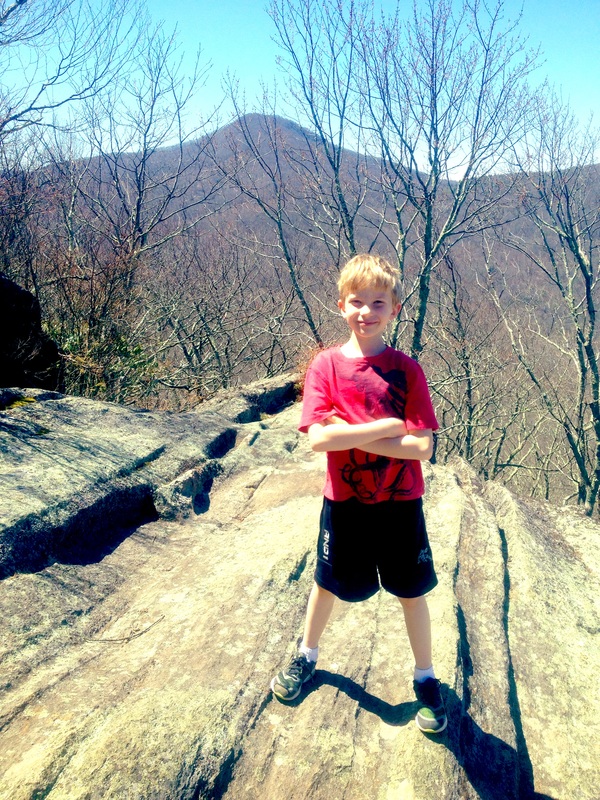
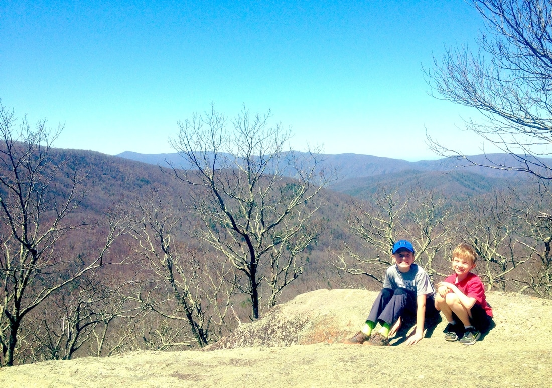
The HIke. It was full-on springtime in Johnson City when we drove to Spivey Gap, one of the near TN-NC crossings where thru-hikers catch rides back to civilization. But up in the gap, the trees still looked like winter and the thrill was the bits of green happening where a spot of sun leaked through or trickle of water was making its way. This is a fine uphill hike, about 2 miles one way, growing steeper as you near the summit. Pack a lunch and eat it on the high rocks; a nice flat and sittable place - even for a group. Only if you bring your own group though because you won't find one up there - this is a remote and less touristed destination where you can't hear cars on distant highways, or see buildings, streets, or other signs of humanity in the valleys below. Since this is an AT hike, the white blazes will guide you. For more information you can always check the trusty Appalachain Treks page: http://appalachiantreks.blogspot.com/2008/08/high-rocks.html
The HIke. It was full-on springtime in Johnson City when we drove to Spivey Gap, one of the near TN-NC crossings where thru-hikers catch rides back to civilization. But up in the gap, the trees still looked like winter and the thrill was the bits of green happening where a spot of sun leaked through or trickle of water was making its way. This is a fine uphill hike, about 2 miles one way, growing steeper as you near the summit. Pack a lunch and eat it on the high rocks; a nice flat and sittable place - even for a group. Only if you bring your own group though because you won't find one up there - this is a remote and less touristed destination where you can't hear cars on distant highways, or see buildings, streets, or other signs of humanity in the valleys below. Since this is an AT hike, the white blazes will guide you. For more information you can always check the trusty Appalachain Treks page: http://appalachiantreks.blogspot.com/2008/08/high-rocks.html
Directions. From Johnson City, head South on I-26 , and take the Temple Hill exit (#43) south of Erwin. At the main road, turn right onto 19/23. Go 1.1 miles until the road forks. Turn to the left, taking 19W for 7.8 miles (very curvy!) to a small parking area on your right for the AT. There's only one small sign indicating the AT, so watch your odometer! The trail to High Rocks heads south (to your right).
