Summit Little Butt Mountain via Point Misery just off the Blue Ridge Parkway, North Carolina.
Winter-time ridge line views. Spring-time flowers and grasses. Stop on the rocky face of Little Butt and look to the left to see Roan Mountain in the far distance. Wow!
The Hike. If you have a day with no sports or musical performances or scouts or potlucks or *insert fun-but-compromising-family-activity*, block the whole day and tell your kids: "We are going to hike to Little Butt." The name in itself should get you a reaction - what kid doesn't love an excuse to say BUTT? Get ready for a bigger reaction when you make it there, though, because it is one of the best vistas on the BRP! We found directions on other websites to be kind of confusing so we hope this is an improvement. On a Tuesday after Memorial day we saw many folks on Crabtree Falls, but we were the only people on this trail!
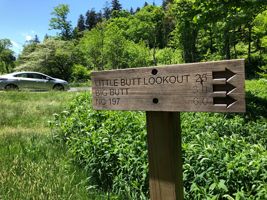
From the Walter Knob Overlook parking area, find the sign above and follow the trail. This is an out-and-back on a well-marked, easy-to-see trail. You will walk the undulating ridge line (great vistas in various directions in winter), summit Point Misery, then walk down and back up again to Little Butt. Little Butt is at the 2.5 mile mark. Look for two spur trails to the viewpoint on your right, about 25 yards apart. You can see the view from the main trail so it should be obvious YOU'RE THERE. The trail continues straight, though, so if you are not paying attention, you might miss them. The viewpoint is a sloping rock, exposed, and hot in the summer (maybe not ideal for a picnic although we have done it twice). As you sit on the rocks, Mt. Mitchell, the tallest peak east of the Mississippi is directly across from you. Look to your left, and the farthest mountain in the distance is Roan Mountain. After you have some time to rest and enjoy, head back the way you came.
Directions. This is a 90 minute drive from our house in JC. Everyone has their favorite path to the Blue Ridge Parkway and any of them are acceptable. We like to head south on I-26 and get off at Weaverville. You are looking for the Walter Knob Overlook, which is at mile post 358.9, 4.4 miles north of Craggy Gardens. Park at the overlook and follow the directions above.
Some side notes: Weaverville is a great place for dinner or ice cream afterwards if you want a treat. Also! There is camping nearby. See our description of the easy, full-facility camping near Mt. Mitchell under the hike "Mt. Mitchell to Mt. Craig." Recently, we camped in a not-easy, not-full-facility space at the top of Mt. Mitchell. There are 9 walk-in sites for tents. They are on a take-your-breath-away scenic ridge near the summit. They are kind of hard to get so you have to look way in advance but parents of young children be warned, this is not a great spot for playing around and there are really no amenities. Plus, the weather up there can be rough.
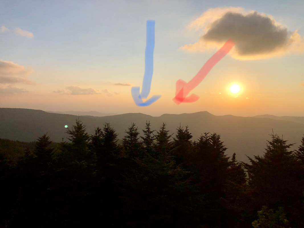
Little Butt Mountain as seen from Mt. Mitchell. This hike is along the ridge line. The trail goes over Point Misery (blue arrow) and there is a lookout at the summit of Little Butt (red arrow; the far left of that higher section of ridge).
