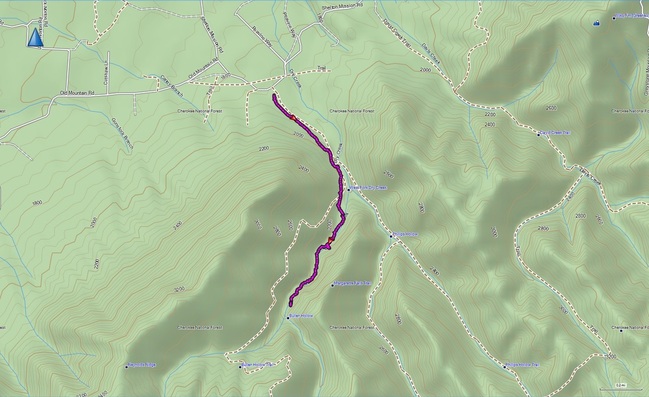
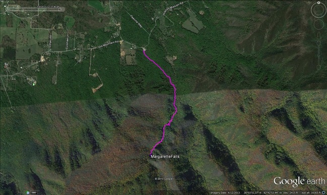
Margarette Falls, Greene County, TN.
Why bother with Great Smoky Mountain National Park?
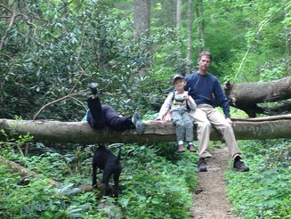
The Hike: This has got to be the most spectacular waterfall hike in the region. The rapids and smaller falls along the way would make the hike worthwhile even if you never made it to the Falls. We found the hike here http://greenevillehikingclub.com/ which has a great description. At the Falls, our GPS had us at 1.77 miles or so, with a few meandering detours, the kids hiked 4 miles round trip that day, which was a first for little Jules. On the one hand, this is a pretty demanding hike; there is significant elevation gain (over 1200 feet), some rough, rocky sections, and a few places where we carried Julian over watery places because the step points were too far apart for little legs. On the other hand, the trail is so full of diversions (bridges, stream crossing, "seeps" where little streams formed in the trail) that it is hard to notice the challenge of getting there! And, like I said, if you just hike to the bridge (0.85) you will have seen some great stuff! The trail is well-marked with blazes and fairly "popular" as Tennessee trails go (i.e., you will probably see a few other folks, but, unlike North Carolina Trails, you won't have to fight for parking at the trail head).
I think we will go back in the summer to play in the pools... see you there!
Directions: We followed these directions posted on Appalachian Treks website: From I-26 take the Erwin/Jonesborough Exit #37. At the end of the ramp, turn west toward Jonesborough, taking State Route 81/107 west for 6.5 miles; stay on Rt. 107 by turning left and continuing for 16 more miles until you reach Route 351, turn left and travel for 4.5 mile, then take another left onto Route 350 (Greystone Road). Continue on for 3.8 miles and then turn right onto Shelton Mission Road. After 1.3 miles, turn right into the large gravel parking area for Margarette Falls, Phillips Hollow Trail, and Bullen Hollow Trail (watch your odometer, the parking lot is easy to pass because the sign for it faces the other direction!). After parking, walk the gravel road for 1/2 mile to another clearing. From here, take the trail to your right and almost immediately you will come to another fork, go left. Follow the trail for approximately 0.7 miles to the falls.
| margarettefalls.gpx |
| margarettefalls.kmz |
