Little Hump in the Roan Highlands.
All kinds of mystery if you're up in the clouds. All kinds of spectacular if they happen to clear.
The hike. This hike is about 2.5 miles each way if you stop at the top of Little Hump. You will love the interesting places you go to drive 'round back the Roan. Tell me if you don't! The trail starts up a double wide/old road that borders a little stream. At a little over 1,000 feet in, you are looking looking looking for this way marker:
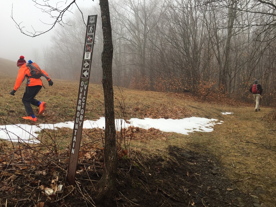
And when you see it, go HARD left, NOT the way either of these people are going in this photo. It's true, on this foggy day, the Jones family got quite lost at this juncture and used a kind of GPS form of divining on animal trails to pick up the trail! This does not have to happen to you. Go left at this sign, and follow the trail along the treeline that travels up, up, along this field. At 3/4 mi. go right to follow the blue blaze and in a few paces you will see a 4-way junction at "Yellow Mountain Gap." Go right, following the Appalachian Trail UP UP UP. Stay on the AT, keeping that and you will be at Little Hump, a fantastic bald that is more remote than the ever-peopled section you've surely hiked near Carver's Gap. Go left, and you'll head down to the shelter and, if you wish, on toward Carver, although it is quite a ways from there!
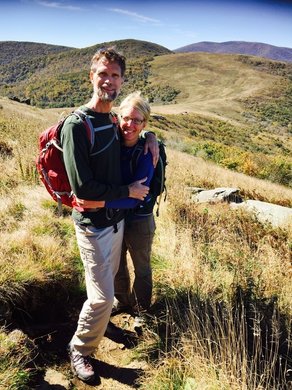
On our foggy day, we had vistas of the floating white only. The boys said the fog made the hike quieter and they were better able to hear their thoughts. On the left is a picture of what it looks like on a clear day: No kids here! This picture was from another time: a 15 miler with all-adults from Carver to 19E and it was fantastic! But with this back way, you get your kids into these incredible places without as much walking. This is very much a non-stop uphill-for-an-hour deal, however!
Directions. Head out through Elizabethton and right on 19E and continue through the town of Roan Mountain. Cross the border to North Carolina and continue through Elk Park. Make a right to stay on 19E following signs to Spruce Pine. Go through the town of Minneapolis, NC. (An interesting fact I recently learned is that the only Johnson City firefighter to ever lose his life fighting a fire, in 1929, is buried in this town). A few miles after, make a right onto Roaring Creek Rd. The turn is just prior to an old white church. About 2 miles in, stay right at the Y to stay on Roaring Creek. At 3 miles, the road turns to gravel. Continue past a few pull-outs until you see a clear "dead end" (there is a total of about 1.3 miles of gravel). At that point, there will be parking around the road for about 5-6 cars. The trail is marked with an official post labeled "Overmountain Victory."
