Pinnacle Tower: The Easy Way, Unicoi, TN.
Short hike. Close. Fun Fire Tower with 360 Views.
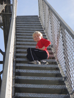
The Hike: Maybe you've heard about Unicoi's new Pinnacle Mountain Trail, a beautiful thing which winds its way 4.5 miles up to a brand new fire tower, sitting at 3,500 feet. It was just built and opened to the public in 2011. But 9 miles round trip is not a little kid hike. So, if you follow Steve's directions, you can drive your vehicle almost all the way to the top using the road on the back side of the mountain. There is some nice parking up there and you can either: 1) join the trail and hike 1.5 scenic miles to the tower; 2) continue walking up the road a little over .5 steep miles to the tower; or 3) hike some combination of the two for the out one way and back the other! Our kids loved this hike when we did it in the Fall of 2011, especially the tower! Note: the road is closed in winter--this year was still closed as late as April, so if it's early in the season you may want to reconnoiter the situation before you load the whole family in the van and head up there! That said, if you DO have the family on board and find the road is closed, you can double back and do the Lone Oak Trail as a nice second option.
Directions: From Cherokee Elementary School take Lone Oak/Dry Creek Road south 5.4 miles, travelling over the top of the mountain and then down, down to a gravel forest service road on the left. Follow the Forest Service Road. At 2.3 miles it will fork. Stay to the left. Toward the top, the road will turn right and you will be riding along the ridge of the mountain. At 3.6 miles, you will come to another fork... stay right. Near the tower (about 5 miles on the Forest Service Rd.), you will come to a well-marked parking lot. Begin hiking up the road, which is blocked to vehicles from that point or hike the trail which picks up on the parking lot side of the road and is denoted by a trail marker distinguishing it from the ATV trails in the area.
Directions: From Cherokee Elementary School take Lone Oak/Dry Creek Road south 5.4 miles, travelling over the top of the mountain and then down, down to a gravel forest service road on the left. Follow the Forest Service Road. At 2.3 miles it will fork. Stay to the left. Toward the top, the road will turn right and you will be riding along the ridge of the mountain. At 3.6 miles, you will come to another fork... stay right. Near the tower (about 5 miles on the Forest Service Rd.), you will come to a well-marked parking lot. Begin hiking up the road, which is blocked to vehicles from that point or hike the trail which picks up on the parking lot side of the road and is denoted by a trail marker distinguishing it from the ATV trails in the area.
